We Share Our Tips From Multiple Family Rides On The Virginia Creeper Bike Trail
My family bikes the Virginia Creeper Trail every year, and it’s an especially favorite destination in the fall. The Virginia Creeper Trail, once a former railroad, is a popular and incredibly scenic 33.4 miles rails-to trails route that runs from Whitetop at the Virginia/North Carolina border down to Damascus, VA and finally through farmlands to Abingdon, VA.
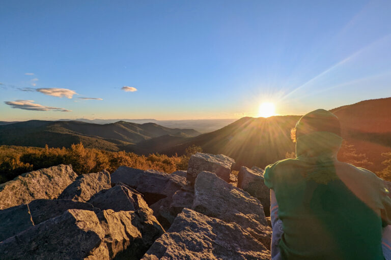
One of my favorite things about the Virginia Creeper Trail is its continuously changing scenery, which keeps things interesting for the kids. The trail takes you on forested mountain descents along mountainside streams, through flat farmland and pastures, over rivers, and across numerous trestles (bridges).
And because it’s mostly on a wide, crushed gravel path, it’s suitable for most families and easily biked on mountain bikes or hybrid bikes. All in all, it’s simply an incredibly entertaining and remarkably scenic bike ride.
P.S. Abingdon, VA is a quaint town worthy of a weekend getaway. See our Abingdon Weekend Getaway blog for details. I also love nearby Grayson Highlands State Park (see favorite hikes here).
IMPORTANT! Hurricane Helene caused significant damage to the Virginia Creeper Trail in late September 2024. The trail section from Whitetop to Damascus was devastated and is closed at least until Fall 2026. The Abingdon to Damascus portion of the Virginia Trail is open. Check trail status here.

Distance Options On The Creeper Trail
You have several options varying in distance and elevation to choose from when biking the Creeper Trail.
- Route 1: Bike From Whitetop To Damascus (17 miles downhill- the most popular option)
- Route 2: Bike From Whitetop To Damascus and Continue To Abingdon (33.4 miles total with mix of downhill and relatively flat from Damascus)
- Route 3: Bike From Abingdon To Damascus (15 miles, relatively flat)
- Route 4: Bike From Abingdon To Alvarado Station (8.5 miles relatively flat with a side trip to a winery or turnaround just shy of Alvarado Station at the popular Holston River Trestle at 7.2 miles)

Tip: Head to The Girl and the Raven Cafe orWhite Birch Food and Juice in Abingdon to start your day with a great breakfast before your ride. (Both restaurants also serve lunch.)
Route 1: Virginia Creeper Bike Trail From Whitetop To Damascus- 17 Miles All Downhill (downhill and most popular)
(Important! This section is currently closed due to Hurricane Helene). Check trail status here. Projected opening is Fall of 2026.
Because of the mountainous steep grade at the Whitetop end of the Virginia Creeper Trail, most riders take a shuttle from Damascus to bike the easy 17 mile downhill section from Whitetop down to Damascus.
The elevation at Whitetop is 3576′ elevation, and you will ride downhill to Damascus which sits at an elevation of 1952′.
For this section of the trail, you may not even need to pedal for some of it- just coast down. You’ll encounter some flat stretches where you’ll pedal more than coast, but the going is generally easy.
This is the most popular route because it is easy for any level of rider including kids, so it’s a great outing for the family.
It’s also one of the most beautiful sections of the trail with mountain laurel and a flowing stream alongside it for much of the way. Bring a picnic and dip your toes in the cold water if it’s a hot day.
If you don’t stop for a picnic, plan on 2-3 hours on the trail with occasional stops for photos and water breaks.
When arriving back in Damascus, grab lunch at the Damascus Diner in the Dragonfly Inn.
Note: The popular, all-downhill section from Whitetop to Damascus section can be crowded on weekends during the summer and fall. For this reason, try to go on a weekday if at all possible.


Route 2: Virginia Creeper Bike Trail From Whitetop To Damascus And Continue To Abingdon – 33.4 Miles (the longest)
Alternatively, you could continue your ride to Abingdon after a break in Damascus and bike 15.5 more miles to Abingdon.
This is doable (I’ve only done this route once), but I got a little saddle sore by the end of it and definitely felt some leg burn even with just the slight elevation gain on the trail from Damascus to Abingdon.
If you’re an experienced biker like my husband, the entire trail from Whitetop to Abindgon is considered “easy.” For the rest of us, it’s doable with some effort.
Elevation in Damascus is 1952’ and you’ll climb just a bit to Abingdon at 2087’.
Plan on an additional 2 hours of biking (if you don’t stop) if you continue biking from Damascus on to Abingdon. See more about this section of the Creeper Trail below under “Bike From Abingdon To Damascus.”
Tips For Biking The Whitetop To Damascus Portion Of The Creeper Trail
- Bring a rain jacket or jacket (in the cooler months). It can get chillier than you think as you build- up speed coasting downhill.
- Bring a basic first aid kit (bandaids for any tumbles).
- Bring a water bottle and a backpack for snacks.
- If you have some in your group who want to go faster, have them stop at the end of each trestle (bridge) to meet up with the rest of the group. There are dozens of trestles on this section of the trail.
- Note that you will not have cell service.
Route 3: Virginia Creeper Bike Trail From Abingdon To Damascus- 15.5 miles (more farmland/pastoral)
Another option is to start in Abingdon and bike towards Damascus. Having done both sections, this one is perhaps my favorite section of the Virginia Creeper Trail.
I like the Abingdon to Damascus route because you can just hop on your bike and go without arranging for shuttles and you get a fairly decent workout. The ride from Abingdon to Damascus is a relatively flat 15 mile ride through farmlands and over long trestles.
On one ride, I’ve had to wait for cows to disperse before continuing. It’s incredibly scenic with views of the rolling hills and mountains beyond.
From Abingdon, you can simply choose to bike for as long (or short) a distance as you’re able and then turn around. It’s fun and beautiful whether you go 2 miles or 30.
It’s definitely not a “coasting” type of ride, and you will have to pedal, unlike the downhill section from Whitetop.
It’s also much more of a pastoral ride rather than the mostly forested and downhill mountainous ride from Whitetop. It’s equally beautiful though, with plenty of wooden bridges to cross along with scenic views.
When we rode this section from Abingdon, we accessed the Virginia Creeper trailhead on Green Spring Road at the Virginia Creeper Trail Welcome Center near downtown Abingdon.
Elevation Change From Abingdon To Damascus
To give you an idea of the elevation gain from Abingdon to Damascus, you start in Abingdon with an elevation of 2087’.
From Abingdon going towards Damascus, it’s downhill as you drop to 1770′ at the popular trestle over the Holston River at mile 7.8, and then it’s a very gradual gain as you come into Alvarado Station (elevation 1900’).
From Alvarado Station on to Damascus, you gain a bit more elevation as it is 1952 feet at mile 15.5. This section of the trail will be hot in the summer as it’s less tree-lined, so start early.
Route 4: Virginia Creeper Bike Trail From Abingdon To Alvarado Station- 8.5 miles (shortest)
From Abingdon, you can bike 8.5 miles to Alvarado Station as a turn-around point. Or you could keep going to Damascus and arrange a shuttle ride back to Abingdon if you want.


Virginia Creeper Trail Mileage Markers And Elevation Profile
Check out the Virginia Creeper Trail Conservancy’s website for more information including the elevation profile.
Miles are measured from the Abingdon trailhead. Mileages in parentheses are from the VA-NC line. (Courtesy of USFS)
- 0 (33.4) Abingdon Trailhead: Limited parking.
- 2.9 (30.5) Highway 677: Limited parking
- 3.7 (29.7) Dry Branch Trestle
- 7.2 (26.2) South Holston Trestle: Scenic trestle over conjunction of South and Middle forks of the Holston River at head of South Holston Lake. Lowest point on trail (1,900 feet above mean sea level)
- 8.5 (24.9) Alvarado: Limited parking
- 15.5 (17.9) Damascus: The red caboose is a seasonal information station. Parking, restrooms in town park. Snacks, etc. in town.
- 17.5 (15.9) Iron Bridge: Enter Mount Rogers National Recreation Area.
- 19.5 (13.9) Straight Branch parking lot.
- 21.0 (12.4) Taylor’s Valley: Parking.
- 24.0 (9.4) Konnarock Junction: Parking. Access to special regulations fishing stream (single-hook artificial lure only)
- 25.0 (8.4) High Trestle: 550 feet long, about 100 feet tall.
- 29.3 (4.1) Green Cove Station: Seasonal Forest Service information station. Portable toilets. Parking. Drinks and water when open.
- 32.3 (1.1) Whitetop Station: Highest point on trail. Parking.
- 33.4 (0.0) VA-NC border: Land on the North Carolina side is private property and most of it is posted. It is NOT a trail.
Bike Rentals And Shuttle On The Virginia Creeper Trail

For convenience, you can rent bikes from an outfitter in either Damascus or Abingdon and get shuttled up to Whitetop. Contact Adventure Damascus for bike rental and shuttle information for starting from Damascus (most popular).
Reserve ahead of time if you can as they can fill up on weekends.
The van shuttle from Damascus to the top of Whitetop takes about 30 minutes on a winding road. If you get car sick, try to sit up front. My kids and I are prone to motion sickness, and we did just fine. But just in case, I always bring a sealable Ziploc storage bag for the kiddos.
If you bring your own bikes, you can pay for the shuttle only.
You can also rent bikes and reserve a shuttle in Abingdon from the Virginia Creeper Trail Bike Shop.
Frequently Asked Questions About Biking The Virginia Creeper Trail
1. When is the best time to bike the Virginia Creeper Trail?
Weekends can be busy so weekdays are ideal. May thru October has the best temperatures and fall is especially beautiful but can be chilly and a bit more crowded.
2. Where to rent bikes/shuttle?
From Damascus, contact Adventure Damascus. They provide the shuttle from Damascus up to Whitetop which is the most popular section of the Virginia Creeper Trail. To start from Abingdon, contact the Virginia Creeper Trail Bike Shop.
3. How long does it take to bike the Creeper Trail?
From Whitetop to Damascus, plan about 2-3 hours depending on stops. Add 2 more hours if continuing on from Damascus to Abingdon.
4. What is the trail surface like?
The Virginia Creeper Trail is not a paved trail but is a mostly smooth, crushed gravel wide path – mountain bikes and hybrid bikes are preferable to road bikes.
5. Can kids bike the Virginia Creeper Trail?
Most kids will be able to easily navigate the downhill portion from Whitetop Station to Damascus. You can also rent pull-behinds for younger kids.
6. Is there cell coverage on the Virginia Creeper Trail?
Cell coverage is limited to none, especially on the Whitetop to Damascus section.
7. Are there restrooms on the Virginia Creeper Trail?
Yes, several vault toilets can be found along the trail at the Abingdon parking lot, Alvarado parking lot, in Damascus near the caboose, Straight Branch parking lot, Creek Junction parking lot, Green Cove train station, Rt 677 parking lot, and Whitetop Station.
Where To Stay Near The Virginia Creeper Trail
The Martha Washington Inn, an attractive and historic hotel, is the place to stay for a memorable but expensive experience. If you can book on a weekday, you will get a less expensive rate. Also, check out their package deals that includes lodging and biking the Creeper (if you need a shuttle or rental bikes).
Another attractive lodging option is to rent a vacation home near the historic district. Here is an example:
Quaint Abingdon Cottage Downtown 420 East Valley Street. VRBO 1939056. 2 bedroom, 1 bath, sleeps 4. Within a 2 block walking distance to historical Abingdon District, local restaurants and the Virginia Creeper Trail is just a few short blocks away.
The hotels that dot I-81 near Abingdon and Bristol are generally a less expensive option. The closest hotels to Abingdon are the Hampton Inn by Hilton and the Holiday Inn Express & Suites.
Both hotels are well reviewed, offer a free breakfast, and are less than 5 minutes from Abingdon’s historic downtown and the Virginia Creeper Trail.
If you are comfortable camping, check out the campground in Beartree Recreation Area. It’s a good location to experience Grayson Highlands State Park and the Virginia Creeper Trail access from Damascus, VA. It’s a 40 minute drive from Abingdon, 41 minutes to Grayson Highlands State Park (another favorite place of mine), and 20 minutes to Damascus.
Hope you enjoy your bike ride on the Virginia Creeper Trail. It’s such a unique and beautiful ride, and Abingdon, VA is a great place to spend a weekend. See our Weekend In Abingdon, VA for more info.